Geothermal Data Gap Analysis Over the Western US

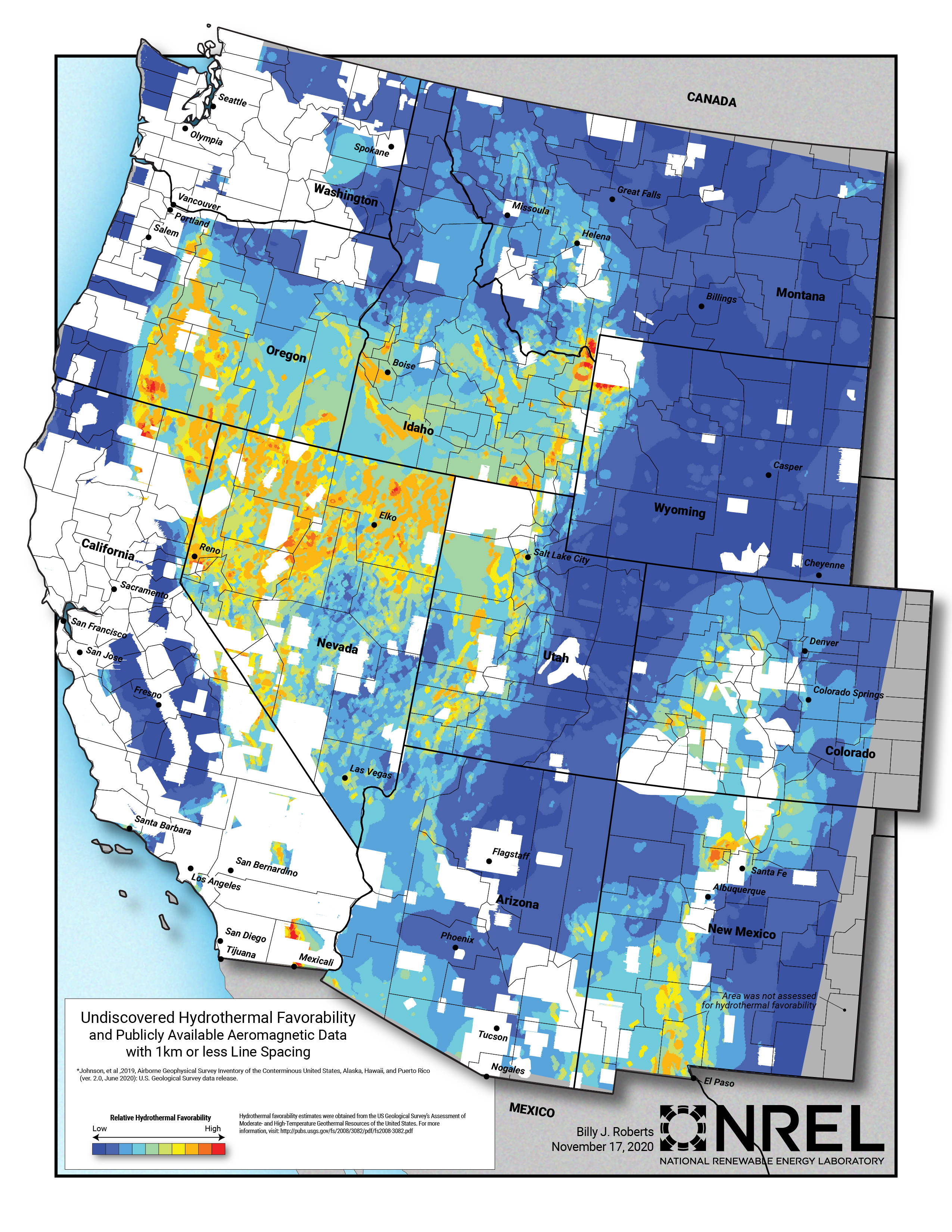
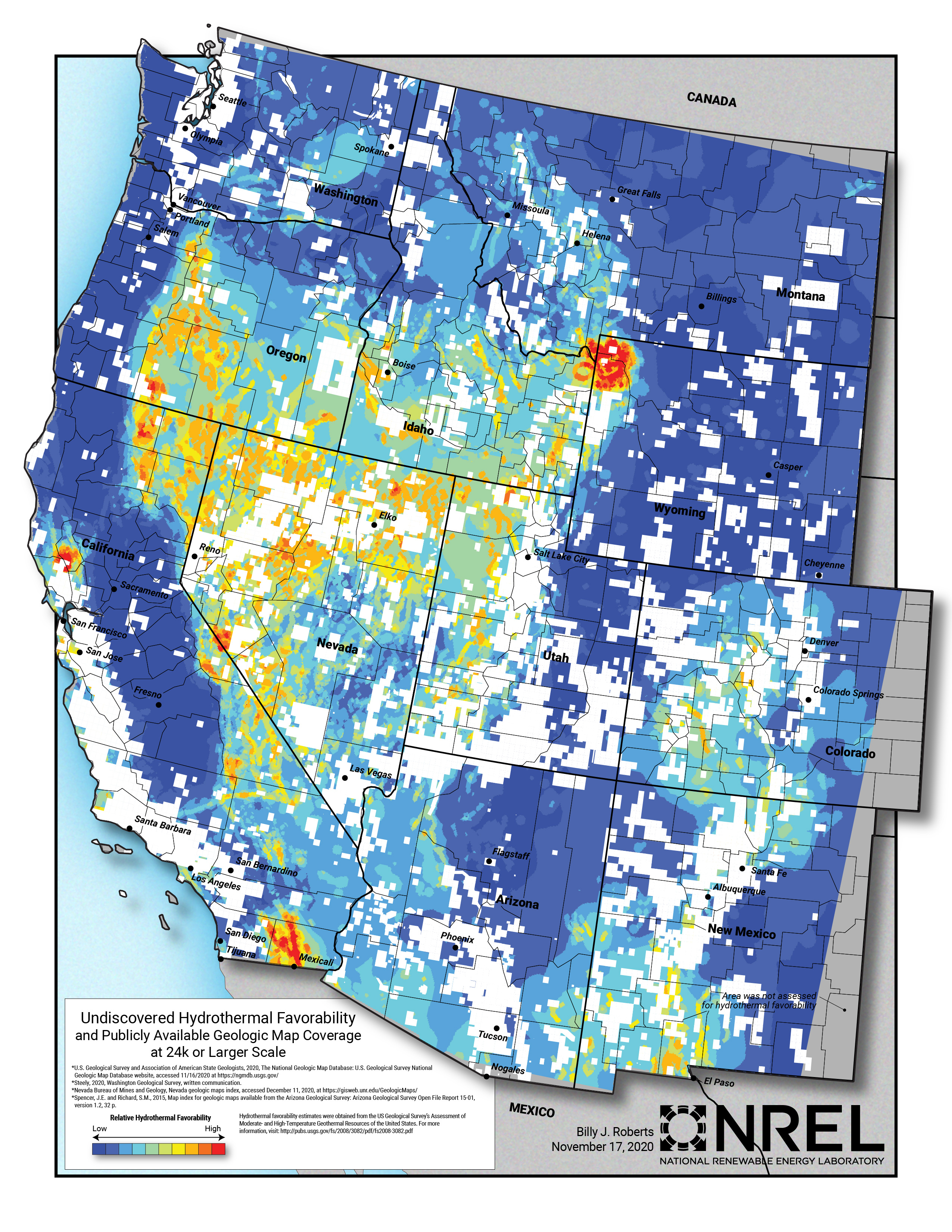
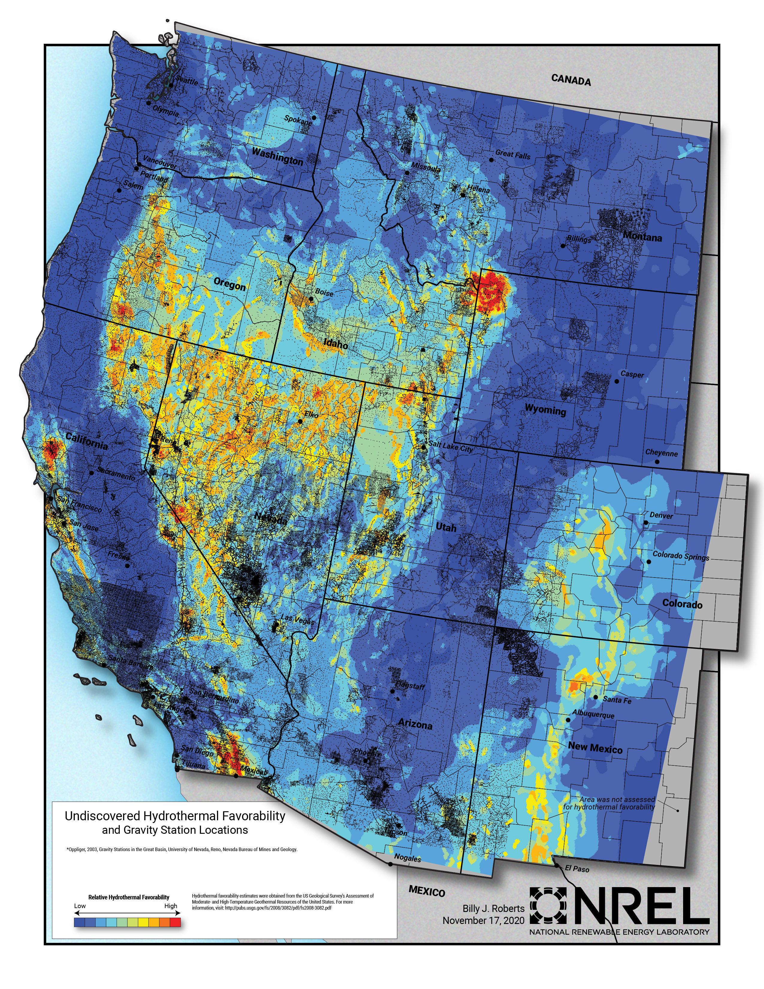
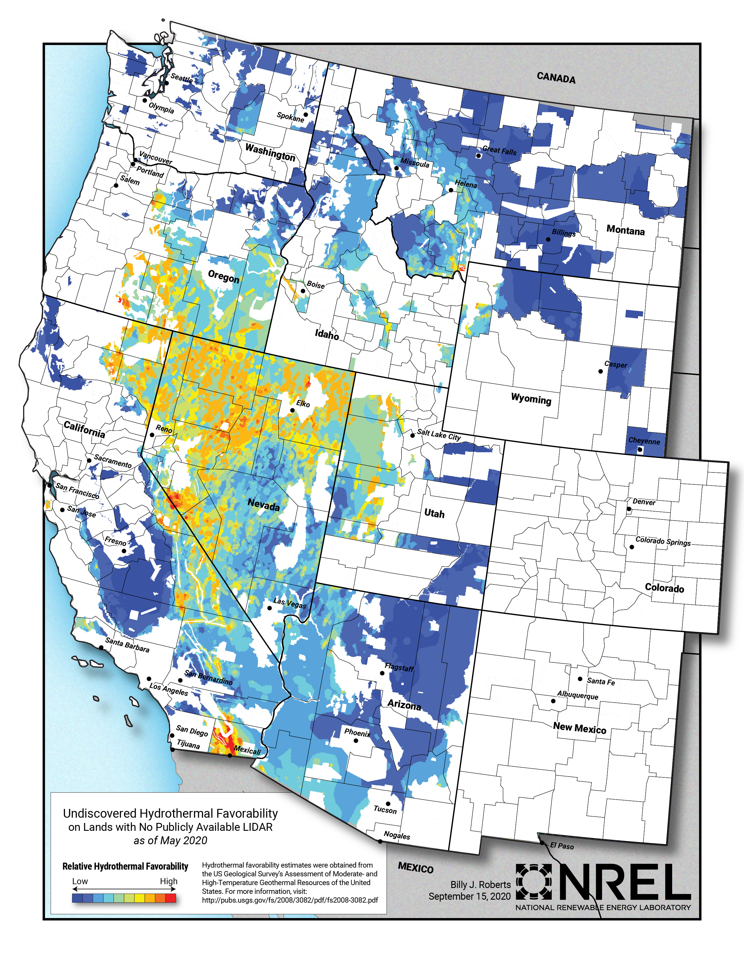
NREL, as part of the Play Fairway Analysis Retrospective, compiled and mapped publicly available geologic and geophysical data in relation to the 2008 USGS geothermal potential analysis. Included in this submission are maps displaying the publicly available data for LIDAR coverage, aeromagnetic coverage, gravity station locations, and geologic map coverage over the Western United States.
Citation Formats
TY  - DATA
AB  - NREL, as part of the Play Fairway Analysis Retrospective, compiled and mapped publicly available geologic and geophysical data in relation to the 2008 USGS geothermal potential analysis. Included in this submission are maps displaying the publicly available data for LIDAR coverage, aeromagnetic coverage, gravity station locations, and geologic map coverage over the Western United States.
AU  - Rhodes, Greg
A2  - Roberts, Billy
DB  - Geothermal Data Repository
DP  - Open EI | National Laboratory of the Rockies
DO  - 10.15121/1756308
KW  - geothermal
KW  - energy
KW  - data gap analysis
KW  - geologic mapping
KW  - geophysics
KW  - PFA
KW  - play fairway analysis
KW  - USGS
KW  - aeromagnetic
KW  - gravity station
KW  - geology
KW  - geologic
KW  - map
KW  - coverage
KW  - LIDAR
KW  - data gap
LA  - English
DA  - 2020/10/01
PY  - 2020
PB  - National Renewable Energy Laboratory
T1  - Geothermal Data Gap Analysis Over the Western US
UR  - https://doi.org/10.15121/1756308
ER  -
Rhodes, Greg, and Billy Roberts. Geothermal Data Gap Analysis Over the Western US. National Renewable Energy Laboratory, 1 October, 2020, Geothermal Data Repository. https://doi.org/10.15121/1756308.
Rhodes, G., & Roberts, B. (2020). Geothermal Data Gap Analysis Over the Western US. [Data set]. Geothermal Data Repository. National Renewable Energy Laboratory. https://doi.org/10.15121/1756308
Rhodes, Greg and Billy Roberts. Geothermal Data Gap Analysis Over the Western US. National Renewable Energy Laboratory, October, 1, 2020. Distributed by Geothermal Data Repository. https://doi.org/10.15121/1756308
@misc{GDR_Dataset_1278,
title = {Geothermal Data Gap Analysis Over the Western US},
author = {Rhodes, Greg and Roberts, Billy},
abstractNote = {NREL, as part of the Play Fairway Analysis Retrospective, compiled and mapped publicly available geologic and geophysical data in relation to the 2008 USGS geothermal potential analysis. Included in this submission are maps displaying the publicly available data for LIDAR coverage, aeromagnetic coverage, gravity station locations, and geologic map coverage over the Western United States.},
url = {https://gdr.openei.org/submissions/1278},
year = {2020},
howpublished = {Geothermal Data Repository, National Renewable Energy Laboratory, https://doi.org/10.15121/1756308},
note = {Accessed: 2026-07-26},
doi = {10.15121/1756308}
}
https://dx.doi.org/10.15121/1756308
Details
Data from Oct 1, 2020
Last updated Feb 18, 2025
Submitted Dec 21, 2020
Organization
National Renewable Energy Laboratory
Contact
Greg Rhodes
303.384.6257
Authors
Keywords
geothermal, energy, data gap analysis, geologic mapping, geophysics, PFA, play fairway analysis, USGS, aeromagnetic, gravity station, geology, geologic, map, coverage, LIDAR, data gapDOE Project Details
Project Name Play Fairway Analysis Retrospective
Project Lead Mike Weathers
Project Number FY20 AOP 3.1.3.7